Tofte District Ranger shares specifics on BWCA reopening and what areas remain closed
News of the Boundary Waters Canoe Area Wilderness reopening in time for most of Labor Day weekend traveled quickly throughout the paddling community and among local businesses impacted by the change from the Gunflint Trail to Ely.
Most of the BWCA will reopen Saturday, Sept. 4.
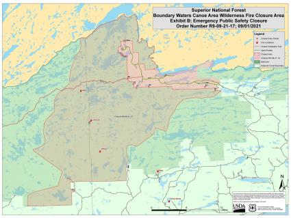
A section of the wilderness will remain closed for at least another week as multiple wildfires continue to burn in an area south of the Gunflint Trail. Click here to view a map of the closure area. The area that remains closed is, generally speaking, west of Poplar Lake to the end of the Gunflint Trail, including Seagull and Saganaga lakes. The closure extends south and moves west from Sawbill Lake, including the popular ‘Lady Chain of Lakes’ west of Sawbill. The Sawbill entry point will reopen on Saturday.
A campfire ban remains in effect for the entire BWCA at this time. The entire wilderness area was closed to all access on Aug. 21 due to active wildfires and a prolonged drought.
WTIP’s Joe Friedrichs spoke with Tofte District Ranger Ellen Bogardus-Szymaniak about the closure and upcoming reopening of the BWCA. The live interview from WTIP’s Daybreak program is from Thursday, Sept. 2. Audio below.
Tweet


